When planning a boating trip, most people check the weather. But one of the most important factors that directly affects safety and comfort is often overlooked: wave height. Understanding how waves behave can completely change how you plan your trip, choose your route, and decide whether conditions are safe.
Waves are not just about size. They are part of a complex system influenced by wind, tides, and offshore conditions. Learning how to interpret wave data helps boaters avoid rough conditions and make smarter decisions before leaving the dock.
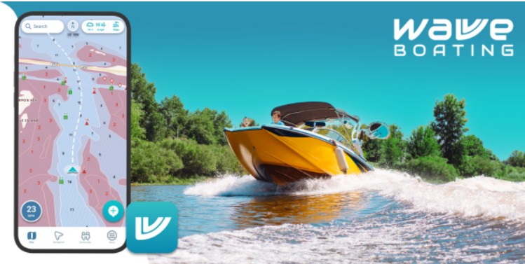
For those looking to better understand and monitor sea conditions, using a wave height app can provide real-time insights into wave forecasts, helping boaters evaluate whether conditions are suitable for their vessel and experience level.
What wave height actually means
Wave height refers to the vertical distance between the crest (top) and trough (bottom) of a wave. In marine forecasts, you’ll often see something called “significant wave height,” which is the average height of the largest one-third of waves in a given period.
This is important because not every wave is the same. In fact, some waves can be significantly larger than the forecasted height. Mariners are often advised to expect occasional waves nearly twice the reported size.
Understanding this helps boaters prepare for real-world conditions rather than relying on averages alone.
Why wave height matters for boating safety
Wave height directly impacts how your boat handles on the water. Larger waves can:
- Reduce stability
- Increase the risk of taking water onboard
- Make steering and control more difficult
- Cause fatigue for both operator and passengers
Wave energy also increases with height, meaning bigger waves carry more force and can be dangerous even for experienced boaters.
As a general rule, if waves approach a significant percentage of your boat’s length, conditions may become unsafe.
The role of wave period
Wave height alone does not tell the full story. Wave period, or the time between waves, is just as important.
Wave period is measured in seconds and represents the spacing between waves.
- Longer wave periods (10–12+ seconds): smoother, rolling swells
- Shorter wave periods (4–6 seconds): choppy, rough conditions
Even small waves can feel rough if they come quickly, while larger waves may feel manageable if they are spaced farther apart.
This is why experienced boaters always consider both height and period together.
Planning trips with wave data
Wave forecasts are especially useful when planning trips in coastal or offshore waters. Instead of guessing conditions, boaters can:
- Choose calmer travel windows
- Avoid exposed areas during high swell
- Adjust routes to minimize wave impact
By reviewing wave forecasts in advance, boaters can avoid uncomfortable or unsafe situations and plan more enjoyable trips.
Avoiding dangerous conditions
Rough water can develop quickly, especially when wind and swell combine. High waves with short periods are often the most challenging conditions, creating steep, unpredictable water.
Wave data helps boaters recognize these risks early. If conditions look unfavorable, it’s often better to delay the trip or choose a more protected route.
Monitoring wave forecasts is particularly important for:
- Offshore boating
- Crossing bars or inlets
- Navigating open coastal areas
Improving comfort on the water
Wave awareness is not just about safety, it also affects comfort. Rough seas can lead to fatigue and seasickness, especially for passengers who are not used to boating.
By choosing conditions with manageable wave height and longer periods, boaters can create a smoother and more enjoyable experience for everyone onboard.
Real-time awareness while boating
Conditions can change during a trip, which is why ongoing awareness is important. Wave height tools allow boaters to:
- Monitor changing conditions
- Adjust speed and direction
- Decide when to return early
Having access to updated wave data helps prevent small issues from turning into bigger problems.
A smarter way to read the water
Modern boating is no longer about guessing conditions. With access to detailed forecasts and real-time data, boaters can make informed decisions before and during every trip.
Wave height and wave period together provide a clearer picture of what to expect on the water. By understanding these factors, boaters can avoid rough conditions, plan safer routes, and improve overall trip quality.
Navigating with confidence
Safe boating starts with preparation. Knowing how to interpret wave data gives you a major advantage when planning your trip.
With the right tools and a better understanding of wave conditions, you can reduce risks, improve comfort, and enjoy a more confident experience every time you head out on the water.

Rachel Collins is the founder and creative voice behind Pun Boom, where words go BOOM! A writer with a sharp wit and a love for wordplay, Rachel turns everyday ideas into clever, laugh-worthy puns that spark joy and creativity. She believes humor connects people one pun at a time and aims to make readers smile with every post. When she’s not crafting puns, she’s exploring new ideas, chasing inspiration, and enjoying the lighter side of life.